Unearthing Ancient Agriculture: How Lake Agassiz Shaped Modern Farming
nasa
1 day ago
Imagine vast, frigid waters stretching across the heart of North America, a colossal lake born from the retreat of glaciers. This was Lake Agassiz, a body of water that once dwarfed the Great Lakes combined. Today, its legacy lives on, not just in the landscape, but in the fertile farmlands that owe their existence to this ancient geological phenomenon.

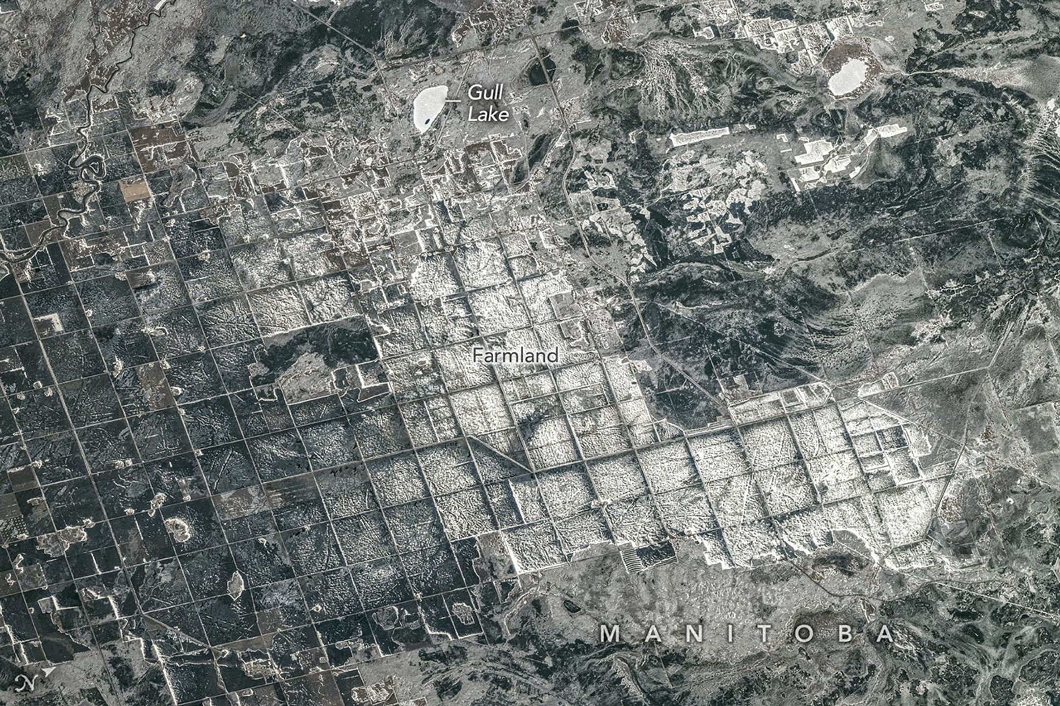
A recent image captured from the International Space Station offers a stunning view of this agricultural heartland, revealing the intricate grid patterns that define the region. But to truly understand this landscape, we need to delve into the history of Lake Agassiz and the unique geological processes that have shaped it.
Around 15,000 years ago, as the Laurentide Ice Sheet receded, meltwater became trapped, forming the massive Lake Agassiz. This lake covered a vast area, encompassing parts of present-day Manitoba, Ontario, Saskatchewan, North Dakota, and Minnesota. Its sheer size – 1,100 kilometers long and 300 kilometers wide – had a profound impact on the land beneath.
Approximately 12,000 years ago, the lake began to drain, leaving behind a rich tapestry of silt and clay. This sediment, deposited over millennia, created a remarkably flat and fertile landscape, ideal for agriculture.
Adding another layer to this story is the Dominion Land Survey, an ambitious project initiated after the Canadian government acquired Rupert's Land from the Hudson's Bay Company in 1869. This survey systematically divided much of Western Canada into one-square-mile sections, creating the grid pattern visible in the astronaut's photograph.
This grid system continues to dictate the layout of farm fields, roads, shelterbelts, and drainage channels, showcasing how human planning interacts with natural history to shape the landscape.
Today, the former lakebed of Lake Agassiz supports some of Canada's most productive agricultural landscapes. The rich soil is particularly well-suited for crops like wheat, barley, oats, and canola.
The astronaut's photograph, taken in April, shows a landscape partially covered in snow and ice. The brightest areas are likely snow-covered farmland or icy ponds, while darker regions indicate forests, wetlands, or exposed ground with less uniform snow cover.
Tags
Original Source
nasa